Introduction
The maps below were developed in support for the USAID/Mali Environmental Threats and Opportunities Assessment (ETOA). The Assessment guides sustainable development across current and planned projects in the Mission’s democracy and governance, education, health, agriculture, trade, nutrition, and climate change adaptation portfolios, and focuses on the role of institutions and partners in environmental protection and natural resource management.
Specifically, the Assessment was developed to support preparation of the USAID/Mali Country Development Cooperation Strategy (CDCS), to be a resource for the development of Project Appraisal Documents (PADs), and to serve as a general resource for USAID and stakeholders in planning and implementation. This Assessment meets the requirement to describe the status of and threats to biodiversity and tropical forestry conservation under Sections 118 and 119 of the Foreign Assistance Act (FAA) of 1961, as amended, and USAID guidance on country strategy development, under Automated Directives System (ADS) 201 and 204. As such, the Assessment supersedes the USAID/Mali 118/119 Assessment completed in 2008.
This Assessment summarizes the development context in Mali; the state of the environment and natural resource management; environmental threats; opportunities to support environmental protection efforts; and the extent to which USAID actions meet the needs expressed in the key recommendations.
Examining Environmental Threats in Mali
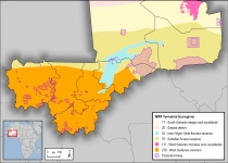
Mali supports a wide range of ecosystems, from the arid Saharan region of the north to the protected wetlands of the Inner Niger Delta to the agricultural areas of the southern Sudanian savannahs, as well as over 1,700 species. This biodiversity, however, is threatened by environmental changes as a result of climate change (e.g., desertification, deforestation, increased variability and intensity of extreme weather events, etc.); exploitation of natural resources for economic development; and lack of institutional support and capacity for environmental protection programs and policies. Mali also experienced a political conflict in 2012 that caused an embargo on international trade and development assistance funds, diverting resources from conservation activities.
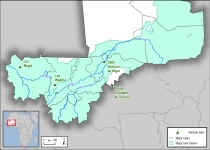
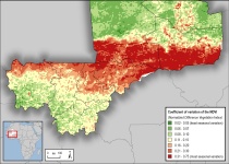
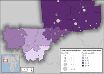
These maps help to strengthen the examination of threats to the biodiversity and environmental status of Mali using data on climatic and geographic factors, species habitat and status, agricultural and economic development, demographic and human settlement trends, and climate change vulnerability. Through analysis of current and potential threats to biodiversity in Mali using the data presented in these maps, recommendations were developed to address root causes and priority issues and provide context for ways in which USAID programs and address these threats.
Disclaimer
The Cadmus Group, Inc. does not own the data used in the creation and development of the maps and datasets listed below, and has obtained or is in the process of obtaining permission to use the data for non-commercial purposes as stipulated by the organizations and agencies in possession of the rights to the data..
Data for download


